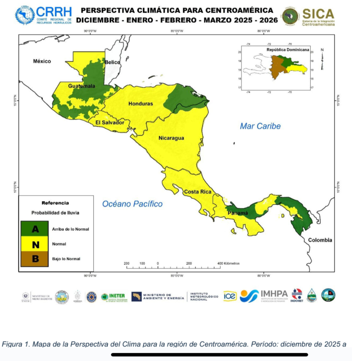
The analysis confirms typical dry season conditions on the Pacific coast, though with the possibility of isolated downpours, while on the Caribbean coast, rains will persist with a slight decrease towards February and March.
On the Pacific coast, the provinces of Chiriquí, central and southern Veraguas, Herrera, Los Santos, West Panama, the southeast of Panama (San Miguelito and Chimán), and the northeast of Darién show a higher probability of rainfall within normal ranges.
For western Changuinola, Bocas del Toro, the Costa Arriba de Colón area, and zones in northeastern Coclé, a normal pattern is anticipated.
Specialist Alcely Lau noted that increases in rainfall, both in the Pacific and the Caribbean, could concentrate mainly in December 2025 and January 2026, with estimated increases of up to 20% compared to historical averages.
Climate models also project an increase of approximately 1°C in maximum temperatures and a decrease of 2°C in minimum temperatures relative to the climatological norm.
In areas like Chepigana, Pinogana, the Emberá Wounán comarca, Chepo, and areas of southwest West Panama (Chame and San Carlos), the forecast points to rainfall above normal.
On the Caribbean coast, accumulations are expected to be above normal in eastern Bocas del Toro, northern Veraguas, northern Ngäbe-Buglé comarca, Costa Abajo de Colón, northwestern Coclé, and Guna Yala.
"Editorial"
The Institute of Meteorology and Hydrology of Panama presented the Climate Outlook for December 2025 and the months of January, February, and March 2026, within the framework of the LXXIX Central American Climate Forum.
For the December-March period, maximums could range between 27°C and 38°C, and minimums near 17°C.
According to Lau, the first rains could occur between late May and the first weeks of June, with a delay of one to four weeks.
Relative humidity would oscillate between 75% and 85%, generating thermal sensations of 35°C to 45°C during the warmest hours of the day.
Regarding wind, an acceleration of flows from the northeast and southeast is expected, with average speeds between 3 and 5 meters per second.
The report also indicates that the end of the rainy season on the Pacific coast will be delayed by one to three weeks compared to the 1991-2020 climatological period.
Furthermore, the transition into the 2026 rainy season could also begin later.
However, IMHPA does not rule out a scenario with accumulations slightly above usual.